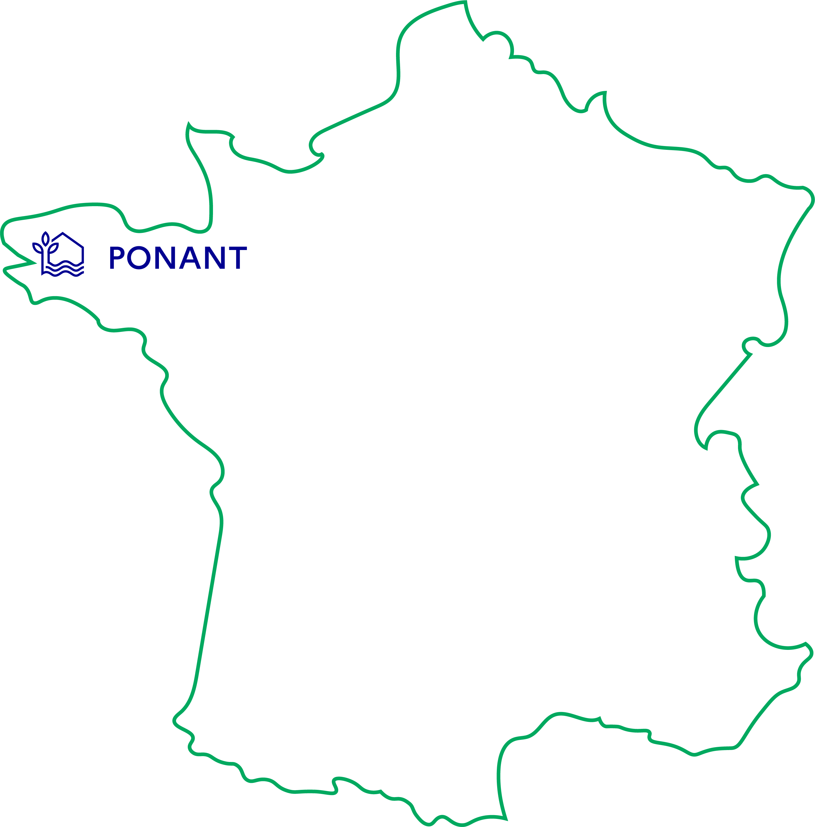
PONANT
living lab
Ponant Living lab
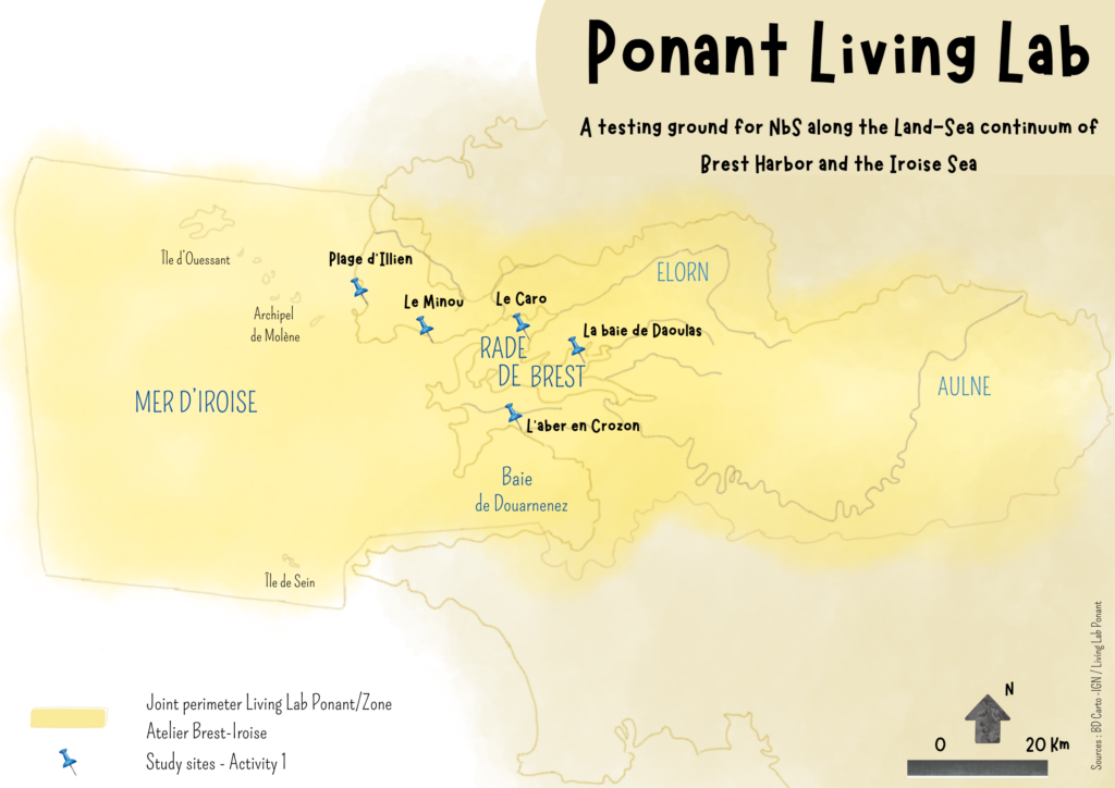
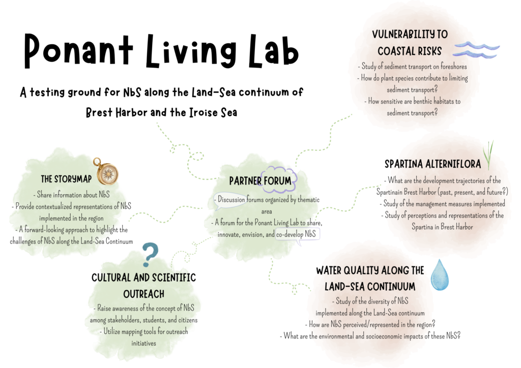
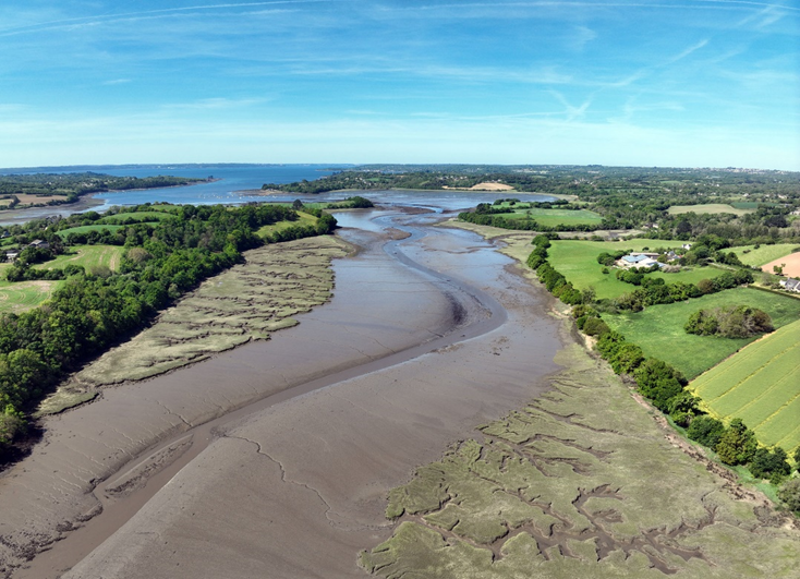
The Ponant Living Lab is studying Nature-based Solutions (NbS) applied to the Brest Harbor and the Iroise region, integrating the land-sea continuum by taking into account the Aulne and Elorn river basins.
Topics covered by Ponant
- Ecosystem Conservation
- Ecosystem Restoration
- Exploitation and use of resources
- Biodiversity Conservation
- De-polderization
- Adaptation to coastal risks
- Well-being of residents and users
- Co-amélioration des Solutions fondées sur la Nature
Priority scientific questions
The Ponant Living Lab’s activities are structured around two main questions, which will be addressed and followed up on through a series of initiatives:
- What NbS can be used to manage the complexity of land uses and the diversity of habitats in this region and foster NbS that benefit everyone?
- To what extent can NbS be deployed to reduce vulnerability to coastal risks such as erosion and coastal flooding?
The actions carried out by the living lab
he Ponant Living Lab is organized around three thematic activities and three cross-cutting themes. As part of Activity 1, “Vegetation-Hydrodynamics-Sediment Interactions,” specific sites are being studied. Activity 2, “Dynamics of Spartina (Spartina alterniflora) in Brest Harbor,” focuses on the study of Spartina in Brest Harbor. Activity 3, “Assessment of NbS along the Land-Sea Continuum,” focuses on Brest Harbor and the Aulne and Elorn watersheds.
The living lab’s activities
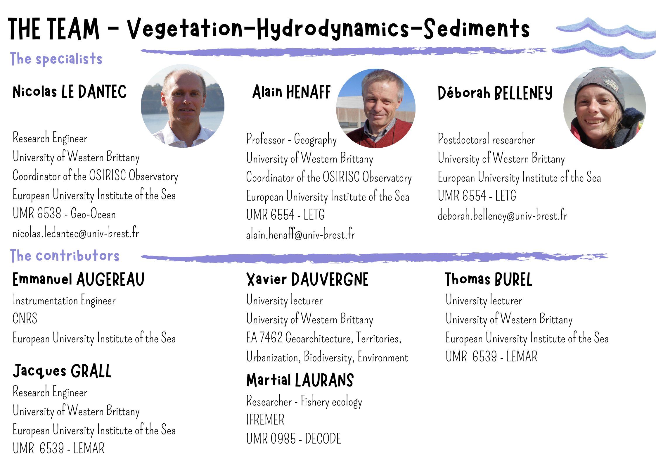
Activity 1 : Interactions Vegetation-Hydrodynamics-Sediments
Activity 2 : Dynamics of Spartina (Spartina alterniflora) in Brest Harbor
Activity 3 : Overview of NbS along the Land-Sea Continuum
Activity 1 : Interactions Vegetation-Hydrodynamics-Sediments
This initiative will help to provide answers on how nature-based solutions can be implemented to reduce vulnerability to erosion and flooding risks.
To this end, three specific points will be examined:
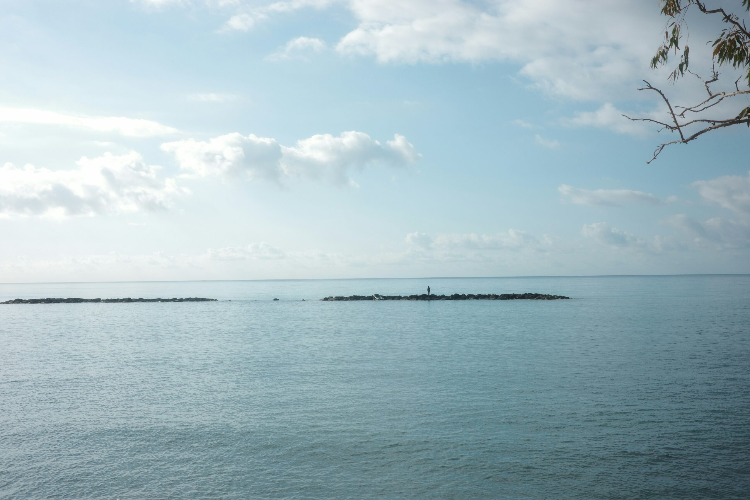
1a. Understanding the sedimentary dynamics of foreshores
Gaining further insight into sediment transport in nearshore areas will, in particular, help improve projections of future coastal changes (in the context of rising sea levels), thereby enabling coastal managers to plan ahead for the management measures that need to be adopted.
This will also make it possible to propose and promote the implementation of Nature-based Solutions that integrate sediment management within a single hydro-sedimentary unit, such as beach nourishment and sediment diversion.
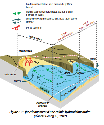
Foreshore
The foreshore is defined as the part of a sedimentary coastline located immediately below the low-tide mark, and includes the beach located in the intertidal zone (between the lowest and highest tide marks, also known as the foreshore) and, in some cases, the dunes.
Beach nourishment
Restoration of a receding beach through the artificial replenishment of sand by truck or boat. The replenished beach provides better wave attenuation and acts as a protective barrier during severe storm events.
1.b. Study of the morphosedimentary changes in nearshore marshes
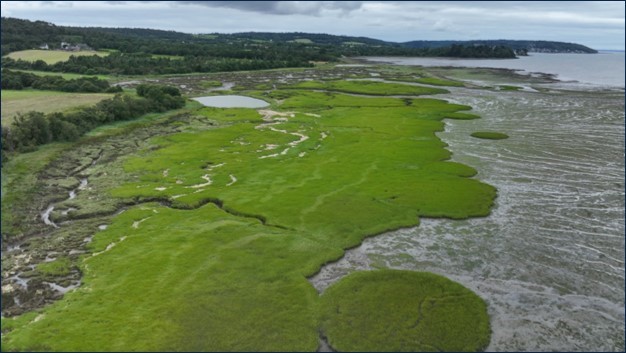
Monitoring the topomorphological changes in nearshore marshes, using both retrospective and prospective approaches, will aim in particular to understand how these coastal marshes might respond to rising sea levels.
Due to their low-lying topography, varying degrees of human impact, and the accumulation of sediment that protects them from erosion and flooding, these environments are vulnerable to current sea-level rise trends but could also serve as buffer zones. A better geomorphological understanding of these phenomena will help inform discussions on the management measures that need to be implemented.
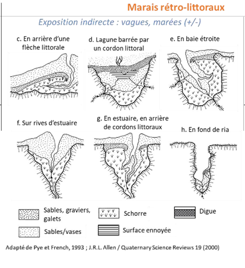
Retro-littoral marshes
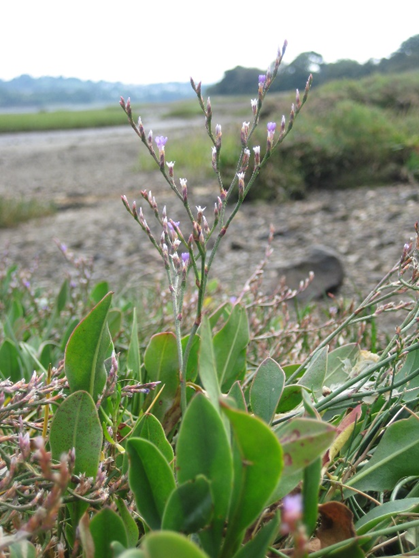
Retro-littoral marshes are indirectly influenced by the tides because they are located behind coastal barriers of sand, pebbles, or dunes. This distinguishes them from littoral marshes, which are directly exposed to waves, swells, and tides. (Alain Hénaff, CAMAB Annual Conference – 2021) They consist of a lower section called the slikke and a higher section called the schorre.
Some Bibliographical References
2. How do plant species help limit cross-shore and long-shore sediment transport?
The aim here is to examine how different plant species help mitigate hydrodynamic forces and limit cross-shore and long-shore transport within coastal cells, along a gradient extending from the backshore to the foreshore. Specifically, the following will be studied:
- wave attenuation by kelp beds and macroalgae
- the canopy effect and sediment trapping by zostera beds
Cross and long-shore
Cross-shore refers to a direction perpendicular to the coast, while long-shore refers to a direction parallel to the coast.
Source : Partenariat Litto’Risques (2023). Guide méthodologique de gestion des risques littoraux en Finistère – Volet 2 : méthodologie de gestion des risques littoraux. 196 p.
3. How sensitive are benthic habitats to sediment transport across different coastal zones?
This study will examine the impacts of sediment transport resulting from natural processes on a seasonal scale (as well as from sediment management operations or sediment redistribution in the context of rising sea levels) on the ecology of benthic habitats within various coastal zones. More specifically, the focus will be on:
- biodiversity in loose sediments following episodes of erosion
- the effects of siltation on rocky reefs and the plant species that inhabit them
Some Bibliographical References
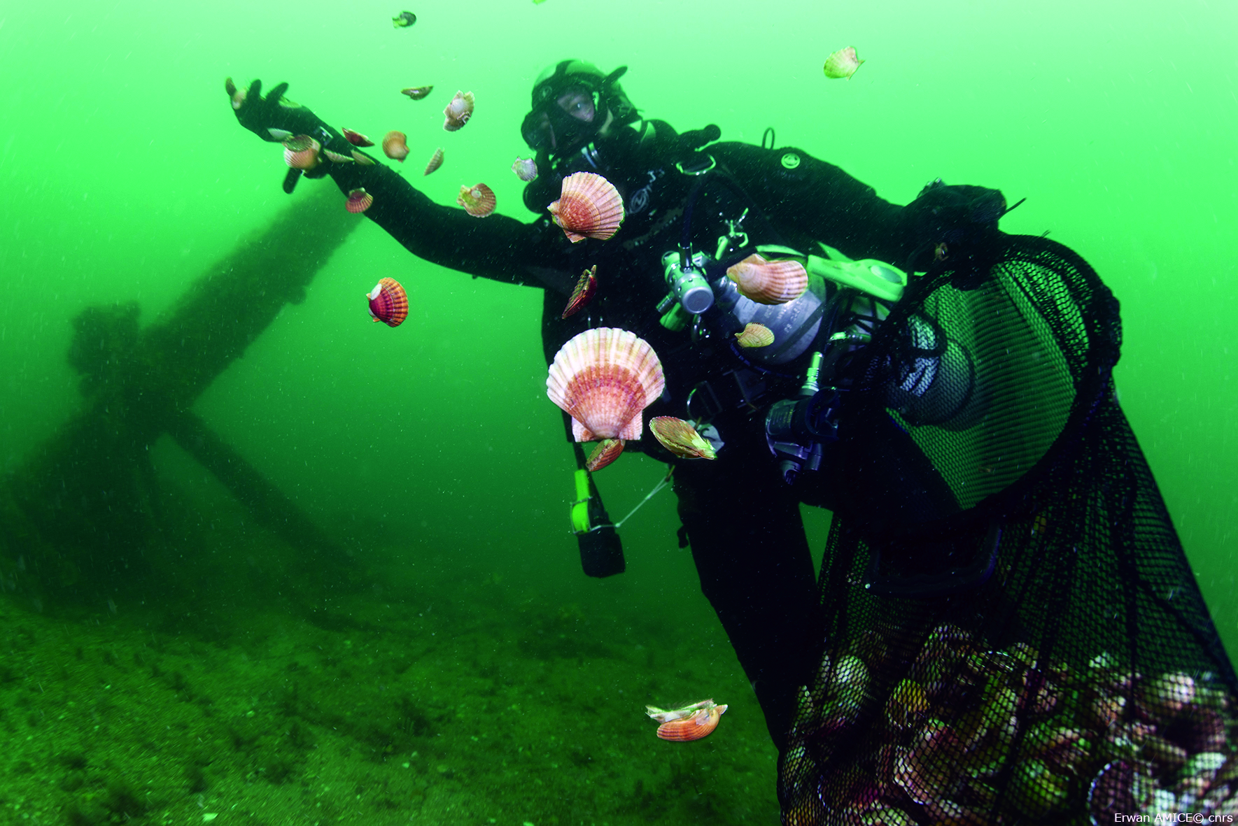
Activity 2 : Dynamics of Spartina (Spartina alterniflora) in Brest Harbor
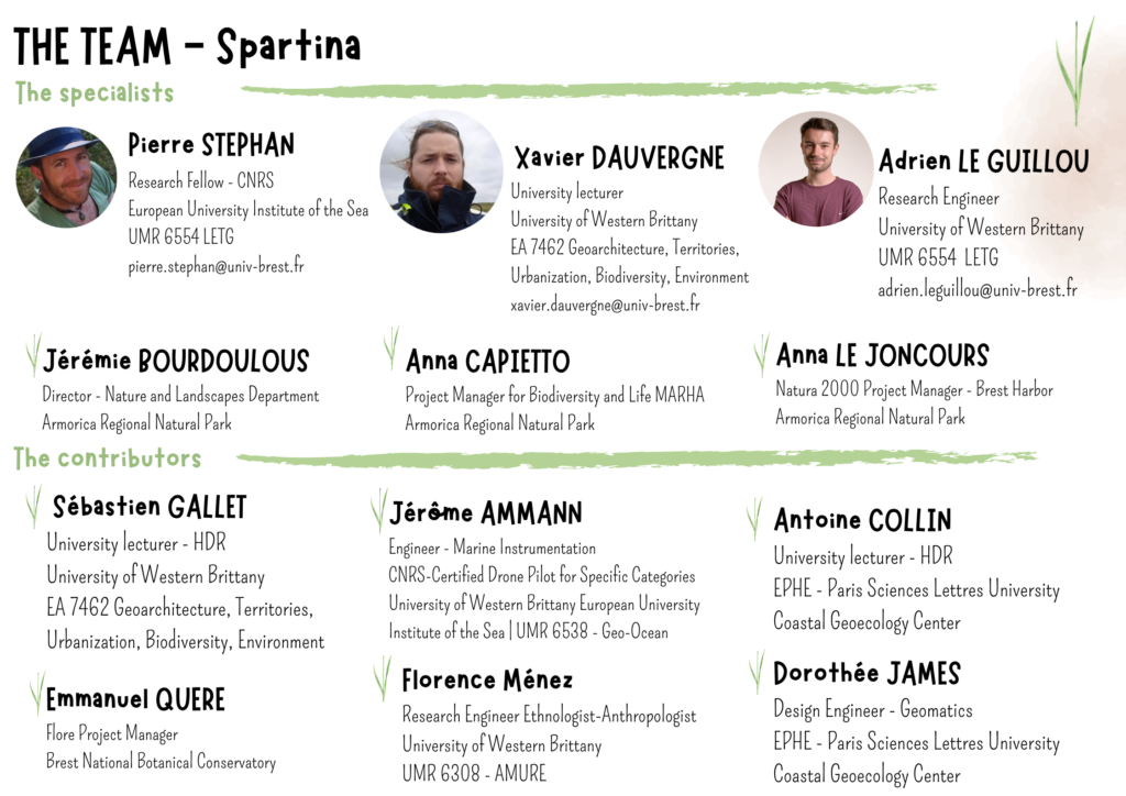
This activity aims to address the needs identified by both scientists and natural area managers regarding the presence of Spartina alterniflora in Brest Harbor.
Spartina alterniflora is an invasive plant species. It was introduced to Brest Harbor at the end of World War I via maritime transport and has since taken over more than 60% of the harbor’s salt marshes. For many years, natural area managers, notably the Armorica Regional Nature Park, have been taking action to combat Spartina alterniflora, which poses a particular threat to Limonium humile, a species of Community interest for which the harbor represents the last remaining habitat in the country.
In this context, the objectives of Activity 2 will be:
- to gain a better understanding of the spread of Spartina alterniflora across the salt marshes of Brest Harbor
- co-develop effective conservation and restoration measures to preserve habitats of interest and the associated biodiversity
Three specific points will therefore be examined:
1. Need to visualize information to better identify areas for action
The goal will be to identify the Spartina’s growth trajectories by applying retrospective and prospective approaches already used in slikke areas and by developing new tools and approaches for schorres areas.
2. Need to evaluate current management measures
The scientists involved in the project will assist managers by implementing ecological and geomorphological monitoring programs to better understand the ecological condition of the salt marshes and the role of Spartina in sedimentation processes in Brest Harbor.
3. Need to develop new Nature-based Solutions
The goal will be to develop innovative nature-based solutions by building on the knowledge gained throughout the program. These solutions will be developed in close collaboration with managers, as well as with a broader range of stakeholders involved in this issue (elected officials, residents of the affected communities).
Some Bibliographical References
Le Meur, M., Dynamique spatiale de la Spartine alterniflore en rade de Brest – mémoire de stage de Master 2, 2024
Lefeuvre, J-C., Rauss, I. – Spartina anglica in the mont saint michel’ bay: a green peril revisited. In: 4th international conference on ivasive spartina – proceedings, juillet 2014, Rennes (France)
Quéré, E. (2010). Vingt ans de suivis et de conservation du Limonium humile Miller en rade de Brest. Bilan 2009. Conservatoire Botanique National de Brest
Activity 3 : Overview of NbS along the Land-Sea Continuum
The Brest Harbor faces water quality issues that affect both economic activities related to the exploitation of marine resources (fishing, shellfish farming) and the rich biodiversity it supports. This situation requires taking the entire socio-ecosystem into account in order to take action to improve water quality, promote biodiversity, and preserve the state of coastal resources, thereby limiting socio-economic and health impacts.
In this context, the Ponant Living Lab aims to promote the development and implementation of Nature-based Solutions that contribute to the restoration of water quality and habitats along the Land-Sea continuum.
The objective of Activity 3 is to improve our understanding of how nature-based solutions related to water resources are currently being implemented or could be implemented in the region, and to assess their environmental and socioeconomic impacts on the “Brest Harbor and its Aulne and Elorn watersheds” socio-ecosystem.
Some of the Nature-based Solutions already implemented in the region include:
- measures to preserve and sustainably manage existing hedgerows, the creation of embankments and hedges, and the preservation of wetlands on land
- conservation and restoration efforts for filter-feeding organisms such as oysters in the marine environment
This activity will seek to answer the following questions:
- Can we identify the Nature-based Solutions implemented along the land-sea continuum, and how are they perceived or represented?
- What Nature-based Solutions are being considered by various local stakeholders along the Land-Sea Continuum for the future?
- What are the environmental and socioeconomic impacts of Nature-based Solutions?
The methodology will be based on facilitating participatory workshops involving scientists, managers, elected officials, and local professionals. A digital model reflecting the shared vision of local stakeholders regarding nature-based solutions will then be developed, enabling the exploration of potential future scenarios based on nature-based solutions and their impacts on water quality and biodiversity.
Some Bibliographical References
Cross-disciplinary Activity – StoryMap & Cultural Outreach

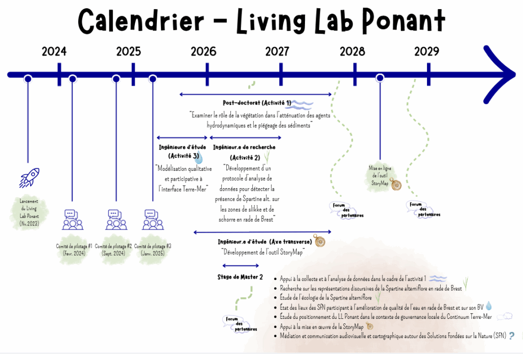
The Ponant Living Lab Calendar
Living Lab News
Pas d’actualités
Academic partners


Research units
AMURE – Aménagement des Usages des Ressources et des Espaces marins et littoraux
CRBC – Centre de recherche bretonne et celtique
Dyneco – Dynamiques des Écosystèmes Côtiers
Géoarchitecture – Territoires, Urbanisation, Biodiversité, Environnement
Géo-Ocean – Géosciences et éco-gestion des milieux marins, côtiers et littoraux
Géosciences marines
LEMAR – Laboratoire des sciences de l’environnement marin
LETG – Littoral, Environnement, Télédétection, Géomatique
LP3C – Laboratoire de psychologie : cognition, comportement, communication
STH – Sciences et Technologies Halieutiques
Societal partners


The Ponant Living Lab identity sheet (FR)
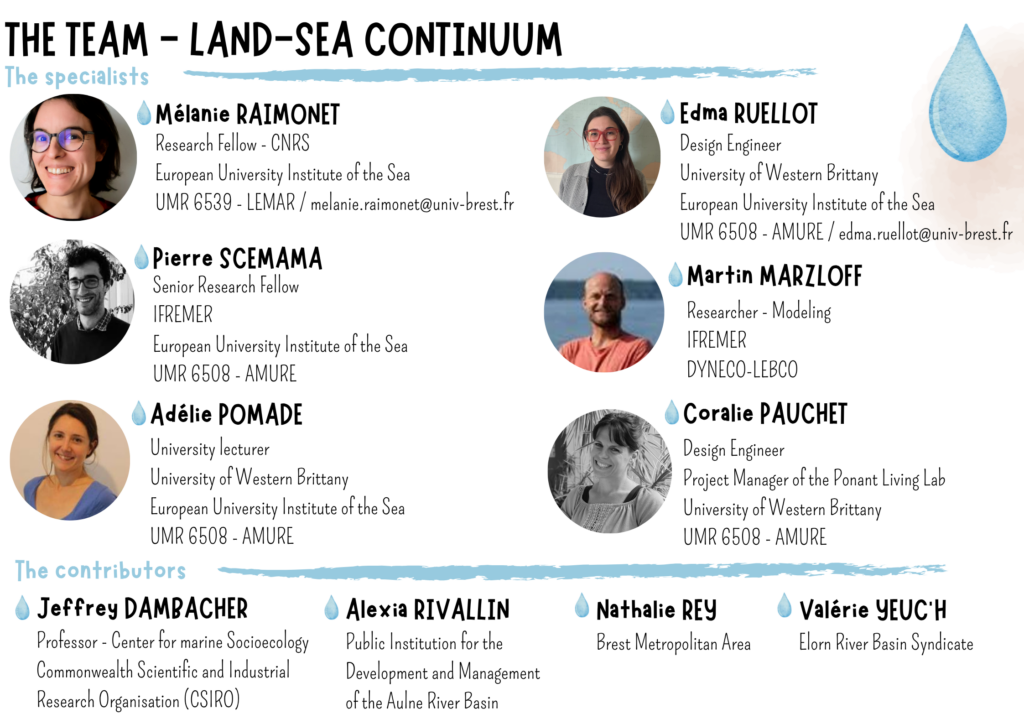
Living Lab coordinators
Coralie Pauchet, Ponant Living Lab Project Manager
Adélie Pomade, Law lecturer at the University of Western Brittany
Pierre Stephan, Geomorphologist at the CNRS